
These area trails offer scenic vistas and a look into the past
As the summer heat begins to wane and the leaves turn to shades of crimson and gold, there’s no better time to get outside on one of the Upstate’s many trails. From short jaunts to full-day treks, there’s a hike for you.
Chau Ram County Park
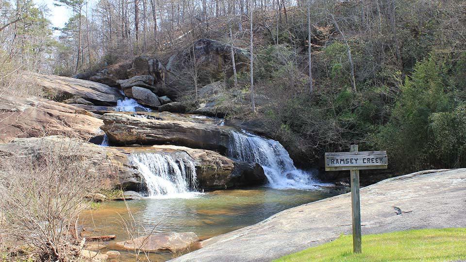
Once considered one of Oconee County’s best-kept secrets, this local park has gained popularity in recent years but still has plenty of places to escape crowds. Many visitors come to view Ramsey Falls, a forty-foot waterfall located just off the main parking lot, across a suspension bridge. Take the blue loop trail and you’ll trace the Chauga River, past rapids and several additional waterfalls.
Cedar Falls Park
Reminiscent of a small Niagara Falls, the surging waters at Cedar Falls in southern Greenville County were once used to power local mills and generate electrical power in the 1820s. Native Americans also used the rock shoals as a hunting campsite and as a way to cross the Reedy River. A partially paved trail passes wide, cascading waterfalls as it continues alongside the river.
Table Rock State Park
Located off State Highway 11, aka the Cherokee Foothills Scenic Highway, Table Rock State Park is easy to access from most of the Upstate and the views of Table Rock Mountain are spectacular. While the park boasts numerous hiking trails, a favorite is Carrick Creek Trail. Busy on weekends but still enjoyable, the trail follows Carrick Creek for a good portion of the hike, passing by several waterfalls. This trail is only a 1.9-mile loop, but it is quite challenging, with some steep changes in elevation and several creek crossings.
Rainbow Falls and Falls Trail at Jones Gap State Park

In the northern part of Greenville County sits Jones Gap, part of the 11,000-acre Mountain Bridge Wilderness Area. With more than sixty miles of trails at Jones Gap State Park, there are plenty of choices. A five-mile steep hike will take you to Rainbow Falls—arguably the best waterfall in South Carolina. Or you can opt for Falls Trail, a 3.2-mile out-and-back trail. This pleasant, moderately strenuous trail traverses boulders and passes several streams along the Saluda River. A toll road built in the 1840s and in use until 1910, the path followed the Middle Saluda River downstream. Now riddled with boulders, the trail looks more like an old creek bed than a road, thus making for an interesting journey.
Clark’s Creek Trail at Kings Mountain State Park
History buffs will love this destination. You get two parks in one at Kings Mountain: Kings Mountain National Military Park, which has a museum and visitor center and is home to the actual battlefield site; and the adjacent Kings Mountain State Park, which contains two lakes, camping and equestrian facilities, and a living-history farm. Clark’s Creek Trail goes through both parks, but you won’t even know when you’re crossing from one to the other. In addition to the historical component, both parks offer amazing views.
An avid hiker, Sherry Jackson is vice president, content at Community Journals. The second edition of her hiking book, Five Star Trails: South Carolina Upstate, is set to come out in early spring 2023. The first edition is currently available at local bookstores and at Amazon and other online retailers.


