

From the western to eastern terminus of the Foothills Trail, a hike takes an unexpected turn
Striding down the trail at Oconee State Park, I marveled in surprise that I’d been there before.
Before I moved to South Carolina, I was just a visitor, meandering down the 2.1-mile trail to Tamassee Knob on a rainy day. Despite the planning that had gone into the later trip—joining the Foothills Trail Facebook group, poring over the guidebook—it never dawned on me that the Foothills Trail (FHT) begins in the same spot as my first South Carolina hike.
The realization felt divine.
The FHT has two ends: the western terminus within Oconee State Park, the more popular place to start, and the eastern terminus within Table Rock State Park. The 77-mile hike would be the longest I’d done, but it was more than that: it was my flag-in-the-ground, this-is-my-home prayer to Upstate South Carolina.
Hikers take anywhere from four to ten days to complete the FHT. I intended to tackle it in five, with the first night spent at Burrell’s Ford Campground along the wild and scenic Chattooga River. After a half-dozen waterfalls and an arduous 17 miles, I rambled into camp at dark and was greeted by another camper, a woman around my age.
Sydney became my first trail friend. And over the next two days, we made two others—Lindsay, a Clemson grad, and Eric, a dad and veteran based in Annapolis. We all spent some time over the next 60 miles hiking solo, but we waited for each other at water crossings because they make the best snack spots, and camped as a unit when we could. There’s nothing quite like sharing time in wilderness that lifts the veil.
The FHT is considered the perfect preparatory hike for those who wish to conquer the 2,198-mile Appalachian Trail for a couple reasons. Both are largely a tunnel of rhododendrons, and water’s rarely far away. One of the trail’s jaw-dropping natural features is Whitewater Falls, which at 411 feet is the highest waterfall east of the Rockies. And for marvel-worthy human influence, farther along you’ll see a 225-foot suspension bridge over the mouth of the Toxaway River, at the top of Lake Jocassee.
Heartbreaker
 At times, the ups and downs of the FHT, which in all has around 14,000 feet of elevation gain, are legendary. Heartbreak Ridge, 49 miles in, includes about 600 stairs, with half ascending and half descending. Your knees? They’ll be counting. Just take your time.
On our fourth and final evening, we were greeted at the Laurel Valley Access parking lot by Kristie, a trail angel I’d met through the Facebook group. We gorged ourselves on her cupcakes, cookies, and salty snacks, and popsicles to beat the heat. Sitting in camp chairs by her hatchback was pure luxury.
We camped two miles later at Chimneytop Gap, the final site before the slog up Sassafras Mountain. Sydney was having doubts—her knees were failing her—but we rallied behind her, sure she could handle the final 13 miles to the end. We were right and rewarded for our perseverance. Sassafras is the state’s highest peak, and Table Rock’s Bald Knob treated us to unmatched beauty.
For me, though, 3.5 miles from the terminus, with a little under 2,000 feet of elevation to lose, is where things got hairy. Up until this point, despite skin caked with dirt and tired feet, I had considered this hike a moderate (albeit lengthy) challenge. But in those final miles, something unexpected came over me, and even now, I’m unsure if it was dehydration, something I’d eaten, or good ol’ fashioned heat exhaustion, but I couldn’t stop getting sick.
When I was brave enough to swig Propel after keeping water down for 10 minutes, the process would start again. Sydney kept pausing with me to lie down along Mill Creek to calm my belly. Lindsay and Eric had hiked ahead, but conveniently, Sydney had saved their numbers the night before. Sparing any messy details, the final three miles should have taken an hour. Instead, they took six.
To this day, I’m stunned by the kindness of these three people. Sydney never left my side. Lindsay and Eric, who had stopped one mile from the terminus so we could catch up and finish together, hiked back to find us. Eric took my pack and scurried back down the trail, and Lindsay kept Sydney company while I tried my best not to just lie down.
Catching up to Eric, I put my pack back on, relieved for the break I’d had. “You might be the best friends I’ve ever had,” I told him.
Much beauty remained in the trail’s final mile. Even in my most nauseated, groggy state, I relished in the beauty of the waterfalls along Carrick Creek. When the four of us crossed the finish line together, I felt a deep appreciation for the trail and the people I found along the way.
Tried-and-Tested Foothills Trail Advice
Unless you want to hike 77 miles twice, you’ll need to hire a shuttle driver to pick you up at your end point. Both parks charge for parking, and while the shuttle driver doesn’t officially charge, it’s wise to pay for their services. I caught a ride from Taz, a fountain of FHT wisdom, and tipped the driver $30. Give the driver a call at 864.431.0447.
If you can’t carry all your food, there’s a decent resupply spot near Whitewater Falls, where you can hide food before starting the hike.
There are several trailheads, giving hikers the chance to hike bit by bit, or bail if they needed.
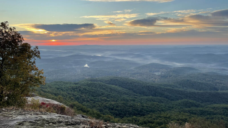
Though much of the trail is forested without expansive views, the flora and fauna you’ll see is wondrous. You may see bear, deer, and eagles, and botanists may notice Jack-in-the-pulpits, rare ferns, and the beautiful Oconee bell.


